Leicestershire Landscapes
Leicestershire Landscapes Are Worth Protecting
Leicestershire’s landscape is diverse, rich, and worth protecting. The county’s landscape is generally gentle and agricultural, shaped by centuries of farming or mining, and with only a small amount of forest cover. Its natural beauty and regional distinctiveness are not well known. However, the countryside is surprisingly diverse with six National Landscape Character Areas identified.
These range from the unique upland of Charnwood Forest to the historically important landscapes of High Leicestershire, from Leicestershire’s wolds to the forest and claypits of the coalfield area and from the gentle Mease/Sence lowlands to the vales.
Charnwood is a unique landscape, with upland features contrasting with the surrounding lowlands. It is formed by a mosaic of heathland, farmland, parkland and woodland and characterised by exposures of rugged, rocky outcrops. The western part of Charnwood lies within The National Forest, which offers people extensive access, environmental education and volunteering opportunities. Charnwood has internationally important geology – which provides fossilised evidence of the earliest forms of multi-cellular life in Britain.
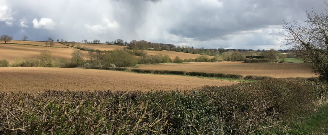
High Leicestershire is a landscape of broad ridges and hidden valleys and has a remote and rural character with small villages and scattered farms. There are rolling fields with a mix of pasture on the higher, sloping land and arable farming on the lower, flatter land, divided by well-established hedgerows, with occasional mature hedgerow trees. The area has important species such as otter, barn owl, yellow wagtail, skylark, lapwing, grey partridge and tree sparrow and at Rutland Water – birds such as the osprey live. The historic character of this area is also important, with its ancient woodlands, deserted villages, veteran trees, historic parklands and areas of archaeological interest, including numerous sites of remnant ridge and furrow and the relatively complete large areas of Midland open field systems which are of national significance.
Leicestershire and Notts Wolds form part of a belt of wold landscapes formed by gently dipping Jurassic rocks which range from the Cotswolds in the west to Lincolnshire in the east. Rutland Water is a significant feature and it is a major source of urban water supply to the region. The Wolds form a watershed between the rivers Wreake, Soar and Trent with streams draining from the central higher land to each of these rivers. Situated in this is area is the historically important Belvoir Castle. There are extensive areas of arable farming on the tops with sheep grazing on the steeper slopes of the valleys. Elsewhere, spinneys, fox coverts, hedgerows, hedgerow trees and streamside trees provide tree cover.
Leicestershire and South Derbyshire coalfield is unenclosed with shallow valleys, low sandstone ridges and a gently undulating plateau. Flooded clay pits and mining have resulted in many subsidence pools or flashes, which together with Thornton Reservoir provide open water sites for nature conservation and recreation. The area has a woodland character that is influenced by the work of The National Forest initiatives. There is grassland over sandstone and in the valleys, and heathland on open mosaic habitats on previously developed land, particularly colliery spoil. The River Mease SSSI and SAC has internationally important spined loach and bullhead fish and nationally important white-clawed crayfish, otter, and aquatic plants such as water crowfoot.
The Mease/Sence lowlands are a gently rolling agricultural landscape around the rivers Mease, Sence and Anker. The area extends across into Derbyshire in the north, Warwickshire in the south, Leicestershire in the east and Staffordshire in the west. There is one Special Area of Conservation (SAC) – the River Mease, which is also a Site of Special Scientific Interest (SSSI). Important habitats include neutral grasslands, wet meadows, parkland, wet woodlands, rivers and streams, all of which support characteristic and rare species of international importance, including the white-clawed crayfish, the spined loach and the bullhead fish.
Leicestershire Vales – a large, fairly open landscape composed of low-lying clay vales and a range of river valleys. The City of Leicester dominates the northeast of this area with other large- to medium-sized settlements including the towns of Market Harborough, Lutterworth and Hinckley. The area is rich in history, with country houses, parkland and examples of ridge and furrow. There are many features and sites of historic interest such as the site of the Battle of Bosworth, near the village of Sutton Cheney, which is of national significance.


